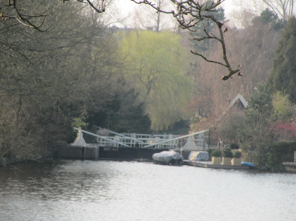
13. Riekermolen
Continue walking straight on Kalfjeslaan to where the road goes up towards the dike of the Amstel River. Turn left and walk on the footpath on the left side of the road to the statue of Rembrandt near the mill (photo 14).
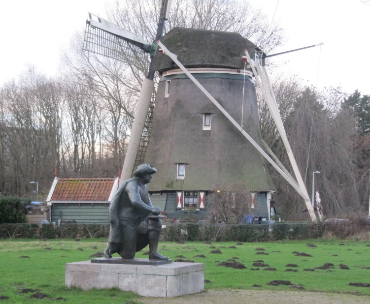
Photo 14: Rembrandt and mill
Rembrandt made landscape drawings along the Amstel. This bronze statue made by Han Wezelaar was erected here in 1969 exactly 300 years after Rembrandt’s death. Now Rembrandt looks out on the spot where the Smient, a ferry for cyclists and pedestrians crosses the Amstel river from May to August.
The mill is called Riekermolen and used to be located near the village of Sloten, located southwest of Amsterdam. The mill was built in 1636 and moved to this place in 1961 when a lake west of Amsterdam was expanded.
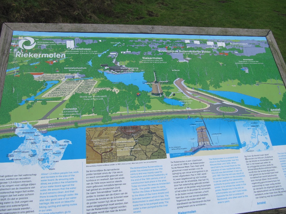
In front of the mill there is an information board.
Question 5: The Amstel river is higher than the area next to it. How is that possible?
Question 6: Is it dangerous that the river is higher than the surrounding area?
Question 7 In which direction does the Amstel water flow?
Question 8: In which direction does the water flow in Buitenveldert?
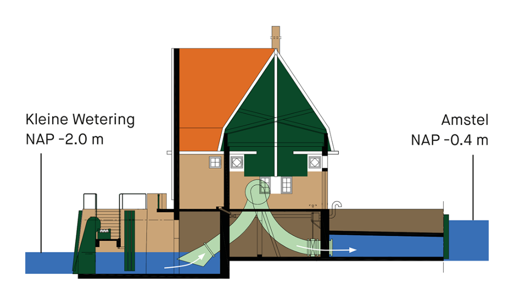
In the Buitenveldertse polder, the water is 2 meters below sea level. The Amstel River is 40 centimeters below sea level. That is a difference of 160 centimeters, see figuur 1.
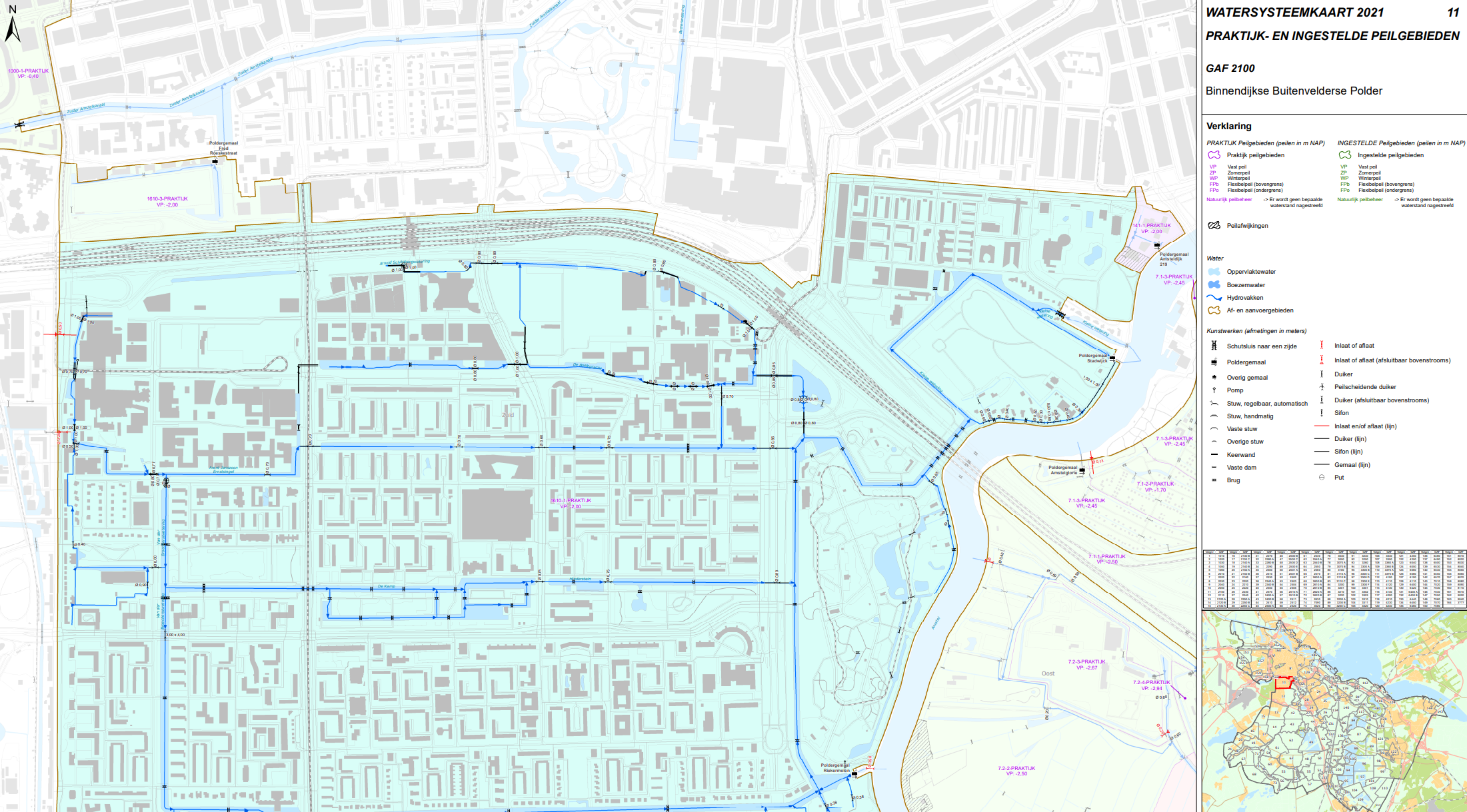
North of the Amstel park and the cemetery Zorgvliet is a pumping station and a lock. If you want, you can walk along the Amstel to the pumping station and back, but it is quite a walk. The water from Buitenveldert flows in the Amstel river at the pumping station, see the map of the the Water Board. This map shows that the entire Buitenveldert polder drains into the Amstel River at the pumping station in the northeast op the area. In an emergency, the Riekermolen can help to discharge water onto the river. The normal situation is that the pumping station pumps excess water from the polder to the river. The maximum capacity of the pumping station is 126m3 per minute. If there is too little surface water in Buitenveldert during drought, water from the Amstel River can be let into the polder via the lock, but that is rare.
Instructions 'Buitenveldert '
- Meeting island in the sixties
- Tree of life
- Go east across the bridge behind the benches
- Straight on to the patio
- Cross Van Leijenberghlaan
- To playground
- To the small football field
- Bovigne
- Van Boshuizenstraat
- From Nederhoven to Kalfjeslaan
- Kalfjeslaan eastside
- Aemstel school garden
- Riekermolen
- Amstelpark
- Mensinge
- Along water
- Holy
- Geerviet and police station
- Gelderlandplein
- Willem van Weldammelaan
- End of walk